
Berliner Wasserbetriebe
In the sense of the application-oriented orientation of the research project, an exchange of feedback between the Berliner Wasserbetriebe and the Straßen-Grünflächen-Amt of the district of Friedrichshain-Kreuzberg took place on 13 March to evaluate the first prototypical results from WP4.2. Specifically, the focus was on how action potential maps for stormwater management facilities can be used in practice and which additional parameters and criteria provide added information value.
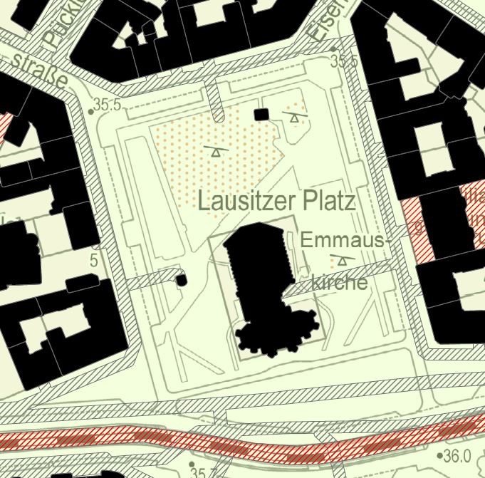
On the basis of the calculated maps in the Berlin AMAREX model area, possible parking lot unsealing was considered using the example of Lausitzer Platz, the usefulness of the maps in the planning process was discussed and further wishes for the digital planning tool to be developed were recorded.
In the first image, it can be seen that according to the current state of the map, there would be no restrictions on unsealing the parking lot areas. A certain part of the surface runoff could be infiltrated on the unsealed parking lot areas.
Further potential for decentralized infiltration can be found, for example, in the construction of troughs or pipe systems. However, since the parking lot is to be used in a certain way, the infiltration trench is preferable to the swale, since it interferes with the surface topography and severely restricts its use.
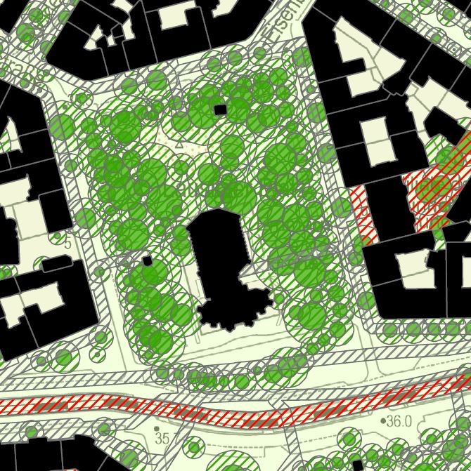
In the second picture, the limitation of the potential building area of infiltration trenches can be seen due to the distance to be maintained by trees. Thus, if implemented in a preferred manner without limiting surface uses, an infiltration system under the church forecourt would be a viable option according to this state of the map.
The foundation for a closer exchange - also on the basis of upcoming implementation projects of the district - was laid and further cooperation in the sense of a practical implementation of the potential analysis was praised.