Reduction and Climate Impacts
Reduction and Climate Impacts
INTRODUCTION
In work package 4, a web-based tool is to be developed that depicts the effects of stormwater management on climate impacts in urban areas in simplified form as maps. This should support early consideration of climate adaptation in urban strategies and planning. As a potentially important criterion for climate adaptation, the long-term deviation of the urban water balance from the natural state will be examined.
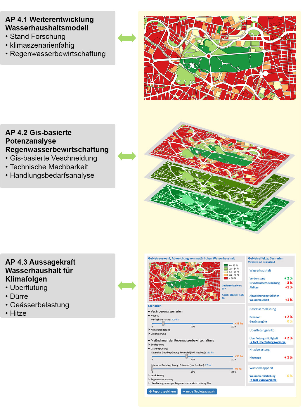
Structure of tasks of WP 4 © KWB
IDEAS
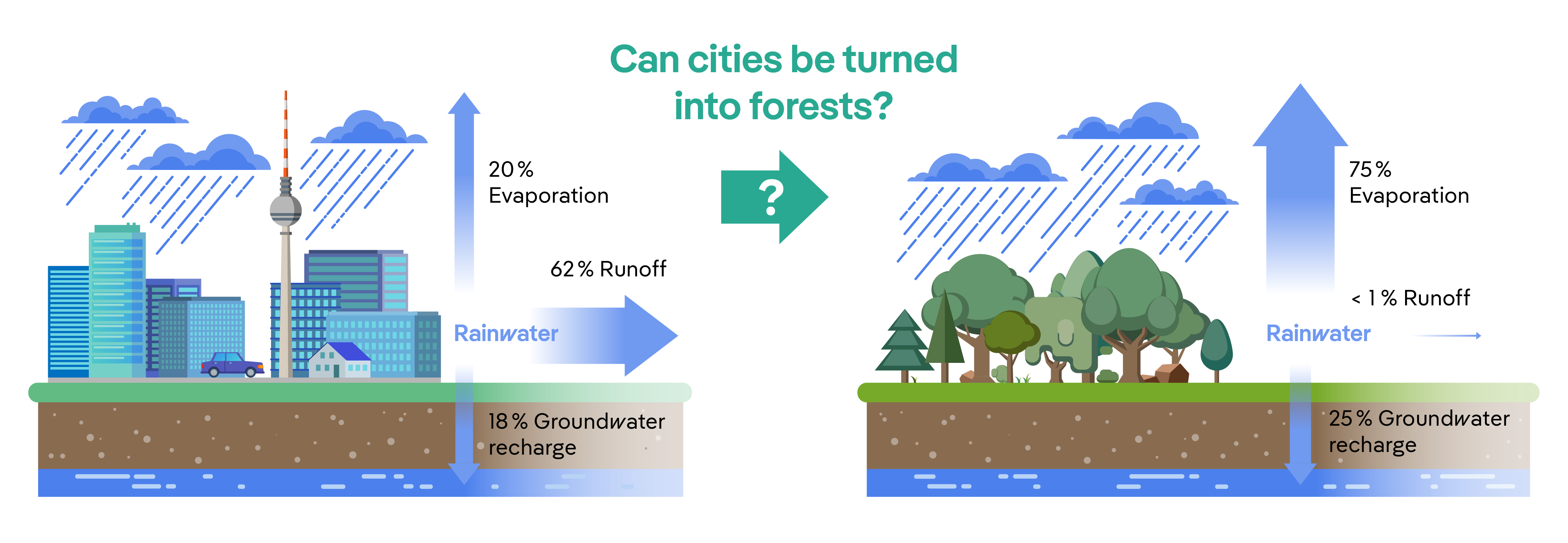
An essential aspect of the investigations is the local urban water balance - i.e. the division of the annual precipitation into the three components evaporation, groundwater recharge and runoff. Compared to a green area, a sealed area usually leads to more runoff (in the canal), less evaporation and slightly lower groundwater recharge. These deviations are the cause of negative effects such as flooding, heat or drought, which are further aggravated by climate change. In AMAREX, the significance of the annual deviation from the natural water balance for these climate impacts and thus their potential for taking climate adaptation into account in planning is now to be investigated.
For this purpose, a valid model tool will be developed based on the water balance model ABIMO 3.2 of the Land of Berlin and, in a second step, compared with the effect evaluation for flooding (from WP 2) and drought (from WP 3).
The second focus of WP 4 is the intersection and comparison of GIS potentials of the different (new) technologies RWB+ and RWB + N with urban and operational needs. Conflicts of objectives as well as synergy potentials of the different objectives are expected. These must be made transparent.
The water balance calculation, the potential analysis and the significance of the deviation of the water balance are made transparent in a web application. This is also set up in three steps in accordance with the scientific work steps.
What is innovative here is not only the individual findings and their presentation but also the cooperation between the scientific research groups and the web programming itself, which is initiated from the beginning in order to constantly compare interfaces, presentation options and needs.
IMPLEMENTATION
In order to be able to use the water balance model ABIMO 3.2 within the framework of AMAREX and beyond, our (associated) partners from the Berlin Environmental Atlas (SenSBW) have made this open source available! The further development of the model at KWB is in full swing, the latest version is available via KWB Github, and various R packages are now available to use the model.
The next step will be to agree on the implementation of the water balance model in a web application.

